If you are not logged in you will not see all the files. Please log in to see all the files available for download.
FREE Aviation-Ranch MAP FILES
Below you will find several KML map files for download. We have broken them down into separate files so you can easily turn them on or off depending on your needs. The Landowner pins have details about the specific landing area. There are also areas where livestock is marked for you to fly high over and areas marked in yellow as "No Launch No Land" If you are flying in the Cordele area please take advantage of the maps below and help us keep our local landowners smiling at balloons! Thank you goes out to Rob Nutting for all of his hard work compiling all of this amazing information. All downloads are free. If you do not see the files below please log in to view and download. If you are not a member please CLICK HERE and become one today. Membership is 100% free and nearly painless.
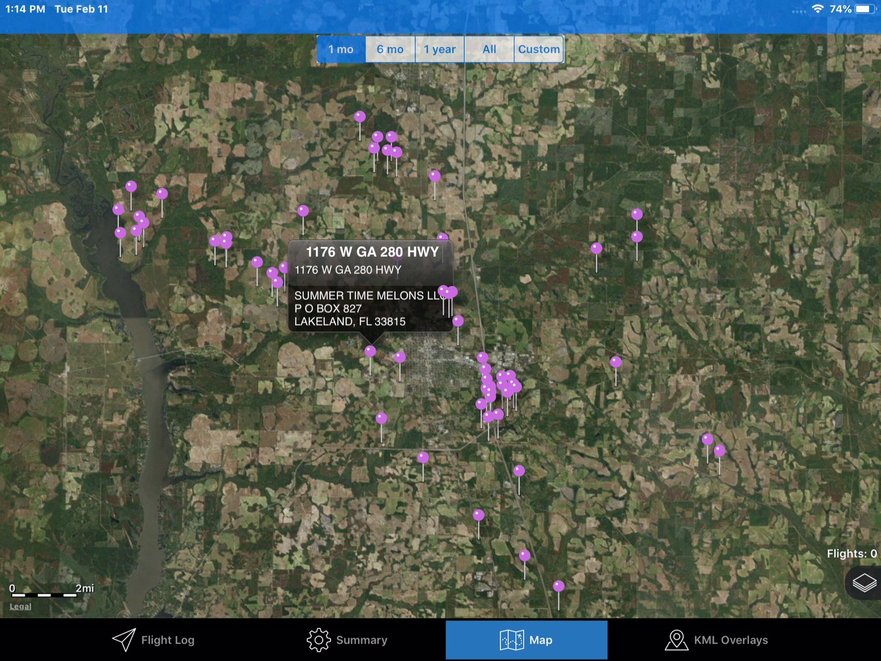
Landowner Pins
 This KML download includes location information, Owner Name, Contact information and any other information we have on each PZ. Feel free to email us with additional information.
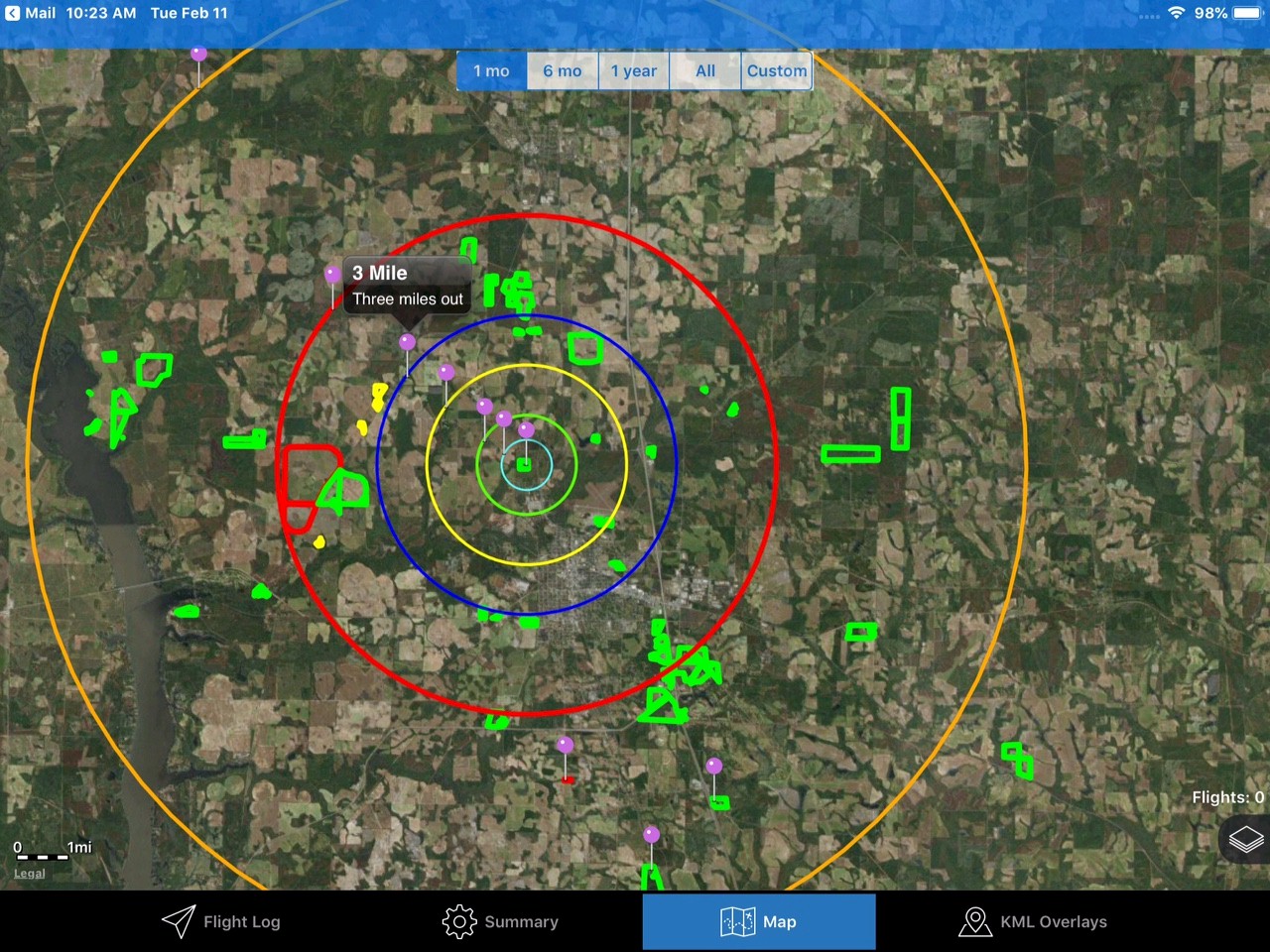
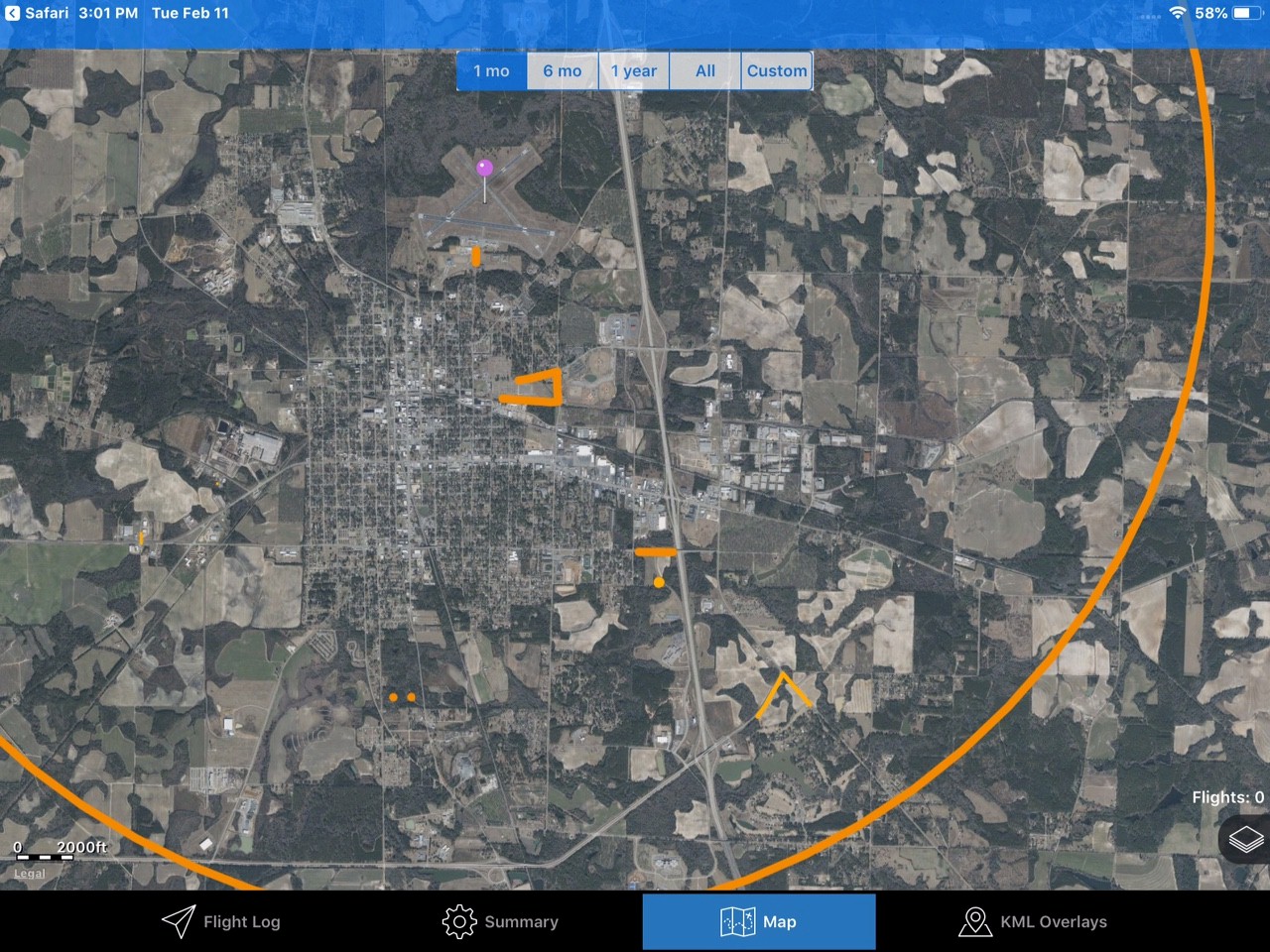
Distance Rings
 Rings for your map that show the distance to the Aviation Ranch.
Aviation Ranch Flying Area
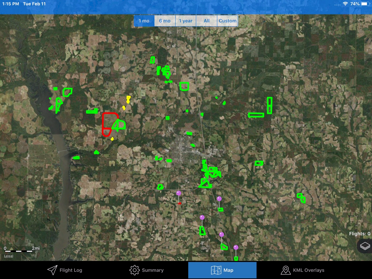
If you are flying in the Cordele area we ask you to please download and USE our area flying KML. This is best used on an iPad or iPad mini with the HotAir.app. To download these files you need to be a member of the Aviation-Ranch site (Membership is FREE). So are these files.
Cordele Crisp County Airport (KCKF)
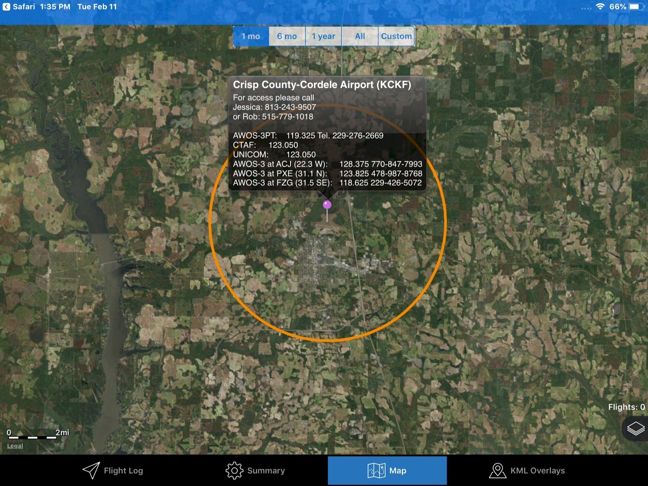
This KML download includes an Airport Info pin with Contact Information, Gate Codes and Com Frequencies.
Hazards
This KML file has known hazards (Power lines, Radio Towers, Cell Towers, Water Towers and more) to watch for when flying and landing in the area. NOT ALL HAZARDS ARE KNOWN OR MARKED. We have just marked ones we know of. Always be on alert.